As my collection of illustrated maps is building up nicely, I thought I would produce a brand new map to add to the collection.
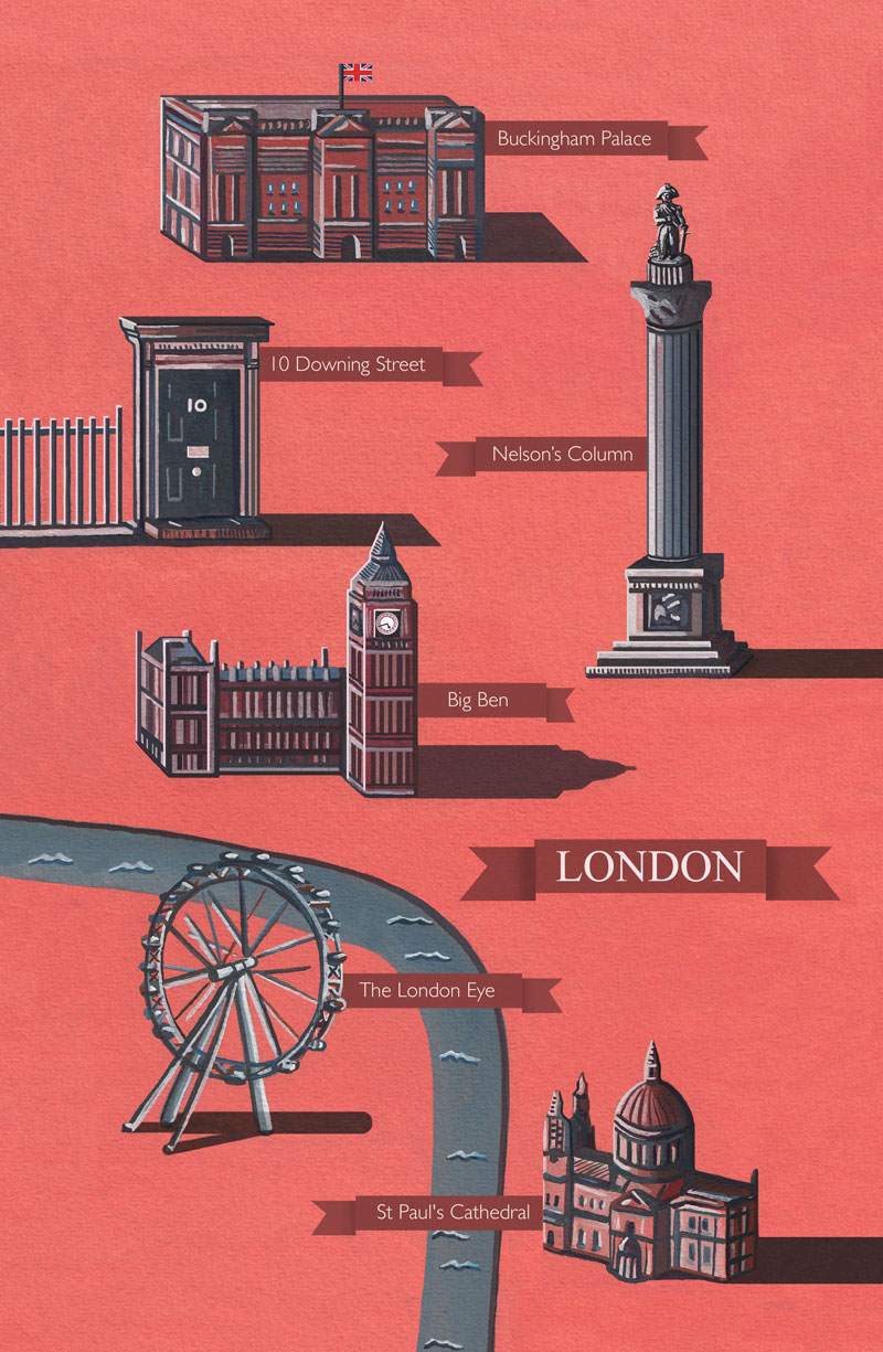
This map features the main tourist attractions of London, from Big Ben, 10 Downing Street to Buckingham Palace.
Below you can also see my sketchbook development of the map, which is always my starting point for any new illustration project. Here you can see thumbnails of my working process, and how I construct my illustrations.
This illustrated map will also be sold in a couple of weeks time at NATO’s Charity Bazaar in Brussels. This is where I’ll be selling my greetings cards, art prints, and original canvas paintings.
It’s going to be a fantastic event, which I’ll also be donating some of my work to charity, which I’m really looking forward to.
I’ve also produced this new illustration for another reason, as I’ll be selling my work with Time Art, which is an artist-run fine art publisher of high quality signed, collectable limited editions and original work of art.
My Paris, Venice, San Francisco and London map’s are going to be sold in their stores, and also online, from Basingstoke to London.
These art prints are going to stretch to 85cm (or 33 inches) tall, so their going to be pretty big. I’m really looking forward to showing you a few photographs of how this turns out, so keep your eyes peeled for that!
For now though, I hope you enjoy this brand new illustrated map of London.
Many thanks for listening and visiting my news page today. You can follow what I’m up to on my Twitter, Facebook or Google + pages, I’ll really appreciate it if you do, and don’t be afraid to say hi to me! Many thanks again, and have a great day!

Illustrated Map Of London
 3rd November 2014